


- Home/
- Delhi Didn't Exceed Average Rainfall In A Week, Weather Body Rectifies Error
Delhi Didn't Exceed Average Rainfall In A Week, Weather Body Rectifies Error
Reported by Reet Kaur Sahni | Updated: August 14, 2026 08:06 IST
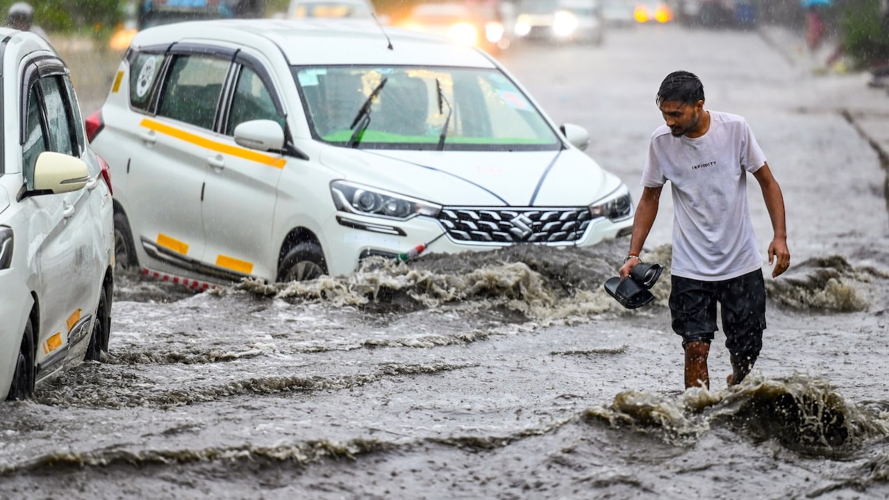
The weather body has listed out what the weather looks like for the national capital
Highlights
- Delhi's rainfall was overreported due to a data entry error corrected by IMD officials
- Heavy to extremely heavy rain is expected in East, Central, and parts of North India
- Coastal regions face squally winds and flash flood risks; fishermen warned against going out
New Delhi :
Over the past couple of days, we have seen numerous fluctuations with regard to the weather. As per experts, the driving force behind the weather is a powerful combination of active synoptic weather systems and extended-range climate drivers, which are inducing significant rainfall across India. Predicting the weather conditions, the India Meteorological Department (IMD) has issued nationwide forecasts detailing heavy precipitation and flash flood alerts. Interestingly, the organisation has also rectified an 'error' made while lodging its data entries for the national capital.
What happened with Delhi's rain numbers?
A typing mistake at the Safdarjung observatory temporarily made it look like Delhi had exceeded its monthly rainfall average. On August 6, the actual rainfall recorded was 18.7 mm, but it was accidentally entered into the system as 56.0 mm. The automated website displayed a monthly total of 230.5 mm, overreporting the actual total by 37.3 mm. Delhi has received 197.2 mm of rain so far this month, meaning it is actually slightly below its normal August average of 226.8 mm.
NDTV spoke to IMD officials who issued a clarification and rectified the data on the national media group.
Delhi weather and Independence Day forecast
The weather body has listed out what the weather looks like for the national capital in the coming few weeks.
August 13-14: Warm and humid with light rain spells during the afternoon and evening.
August 15 (Independence Day): Expect cloudy skies with scattered light rain. There is a high chance of an early morning shower (4:00 AM to 6:00 AM), followed by lighter drizzles between 6:00 AM and 9:00 AM and during the afternoon.
August 16: Intermittent light rain will keep maximum temperatures comfortable around 33 to 35 degrees Celsius.
Where is heavy rain expected? IMD Explains
East and Central India: The active depression originating over West Bengal is tracking north-westward across Gangetic West Bengal and Jharkhand, triggering heavy to extremely heavy rainfall spells across Gangetic West Bengal, Odisha, Jharkhand, and Chhattisgarh.
North India: Multiple active systems, including a Western Disturbance and lower-tropospheric cyclonic circulations, are driving heavy rain across Himachal Pradesh, Uttarakhand, Punjab, Haryana, Delhi, and Uttar Pradesh.
Coastal Warnings and Flood Risks: Squally winds reaching speeds up to gusting to 65 km/h are affecting the coasts of West Bengal, Odisha, and North Andhra Pradesh. Fishermen have been warned to stay out of the sea, and low-lying watersheds in these regions face active flash flood risks due to heavy runoff.
Two-week weather outlook
Mid-August (August 13-19): Overall rainfall across the country is expected to be normal. Central and East India are predicted to see good rain, with Peninsular South India staying mostly dry.
Late August (August 20-26): A new storm system is expected to form around August 20. This will bring heavy rain back to Central India, the Western Ghats (including Goa and Coastal Karnataka), and the northern mountain regions.
Global Climate Drivers: Moderate El Nino conditions in the Pacific Ocean continue, which will keep influencing monsoon patterns through the season.
Advisory: Farmers in heavy rain zones (Odisha, West Bengal, Chhattisgarh, Uttarakhand, and Karnataka) have been advised to clear drainage outlets so standing crops like rice, maize, and soybean do not rot in flooded fields. An advisory has also been issued to hold off on applying fertilizers or pesticides until heavy rainfall stops. Farmers have also been advised to prop up banana plants, papaya trees, and tall vegetable crops so strong winds don't knock them over. Apart from this, an advisory has also been issued to keep livestock inside dry shelters during storms and place nets over fishponds to prevent fish from swimming away during field overflows.
Published: August 14, 2026 08:06 IST
 Reported by Reet Kaur Sahni | Friday August 07, 2026
As per the ministry, prior Environmental Clearance becomes mandatory for data centres depending on their physical footprint under Schedule 8 of the EIA Notification, 2006.
- Written by Sambhav Kumar | Thursday August 06, 2026
Keerthy Suresh's 41-hour no-sleep stretch highlights the intense demands many professionals face, but experts warn that prolonged sleep deprivation should never become routine.
- Written by Sambhav Kumar | Wednesday August 05, 2026
Preliminary evidence suggests the blood filtration treatment could reduce some microplastic particles, though findings are limited and require more study.
- Monday August 03, 2026 , New Delhi
Study reveals black crust from pollution weakens Humayuns Tomb sandstone
- Written by Debosmita Ghosh | Saturday August 01, 2026
Lung cancer is often diagnosed at an advanced stage because its early symptoms are easy to overlook. A persistent cough is among the most commonly ignored warning signs.




................................ Advertisement ................................


Blog | Well Done, Delhi. You've Turned Lung Sacrifice Into A Badge Of HonourSaikat Kumar Bose
Monday November 10, 2025Till some years back, Delhiites would ask angry questions to those in power about the capitals annual tryst with toxic air. This has changed. Those in the driving seat dont see the need to answer now.
Opinion | Why Indians Have Just Given Up On Air Pollution CrisisTanushree Ganguly
Friday December 20, 2024While some may argue that people in Delhi are now more aware of air pollution than they were a decade back, my rebuttal would be that awareness does not mean that people are concerned.
Opinion | You Must Outrage Over Filthy Air More Than Once A YearJyoti Pande Lavakare
Tuesday December 10, 2024Delhi welcomed us with monsoon rains and mangos. We were home. Fast forward a couple of years, in the winter of 2012, I found myself in denial about something other parents, mostly expats, were calling toxic air.
Opinion | Delhi's Air Pollution Situation Is Like A Bad MarriageNishtha Gautam
Friday November 22, 2024On a good day, such as today, the AQI reading in Delhi is 407. We are jubilant at the sickly sunshine trickling through the slightly dissipated smog. At least its not 1600.
दिवाली... पराली... सियासी जुगाली!Ashwini kumar
Monday November 18, 2024दिल्ली-एनसीआर में प्रदूषण का समाधान तो आज तक मिला नहीं. हर साल चिंतित होकर हम-आप सांसों की तकलीफ के साथ-साथ दिल और ब्लड प्रेशर के मरीज भी क्यों बनें?


